Water Monitoring
The North Platte NRD requires sound information on which to base any water management decisions and has developed an extensive program of monitoring the quality and quantity of the groundwater resources within the district.
Groundwater Level Measurements
In the spring, summer and fall of each year, NRD groundwater technicians measure groundwater levels in nearly 800 wells throughout the District. Data from these measurements are stored and analyzed, providing a reliable, long-term record of groundwater trends. Data is then integrated using Geographic Information System (GIS) technology that allows for storage and mapping.
Web Mapping Application
Data collected at each monitoring well is made available via our web mapping application. The North Platte NRD has created hydrographs and nitrate levels for each active monitoring well. Along with maps, we have included important associated data for each actively monitored well in the District.
Go to the Web Mapping Application
A Better Understanding
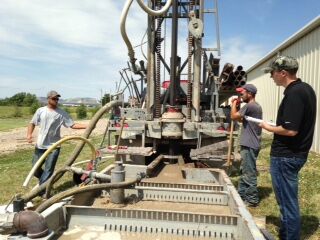
The well drilling process yields samples of sands and gravels that can be analyzed to determine the geology of the sub-soils. By better understanding the geology of the aquifers, NPNRD staff can better understand how the water moves through the ground. To see how the NRD’s water monitoring programs fit into to the decision-making process, visit our technology page.
Resources
- Timeline for Development of Current Active Wellsn (Press the play button on the bottom left of the page)
- Our Water Monitoring Programs and the Decision Making Process
Gallery
Click image to view larger.
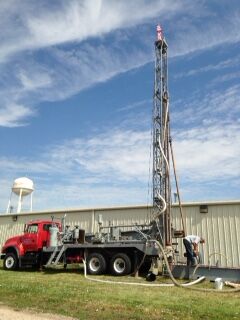
Monitoring Well Rig and Workers
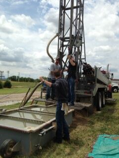
Monitoring Well Drillers Working in the Field